Tippu Sultan’s Upper Fort and Citadel and Nagalacheruvu (Notified as Tippu Sultan’s Upper Fort and Citadel and Nagalacheruvu)
Locality: Bellary,Bellary- Taluk & District: Geo-Coordinates: Lat.15 149086 N: Long 76 91 E Approach: Airport: Vidya Nagara Toranagallu, Hubballi &Bengaluru, Railway Station: Bellary, BusStation: Bellary.
Brief History
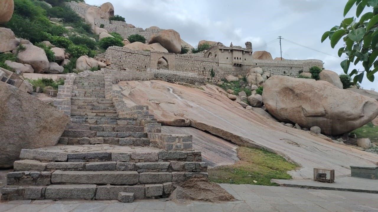
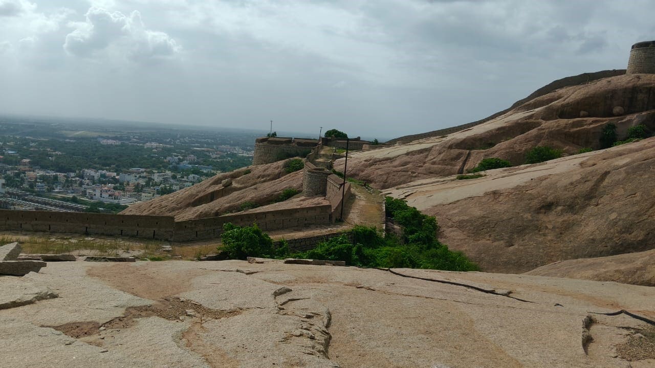
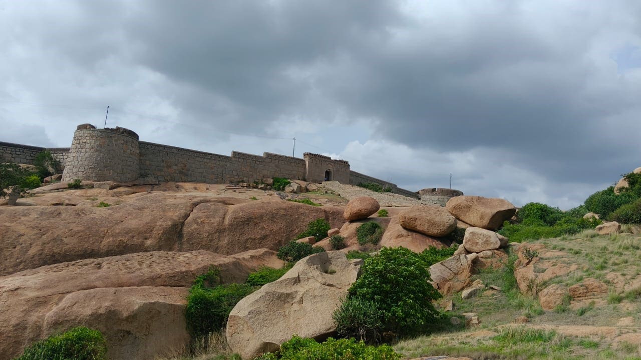
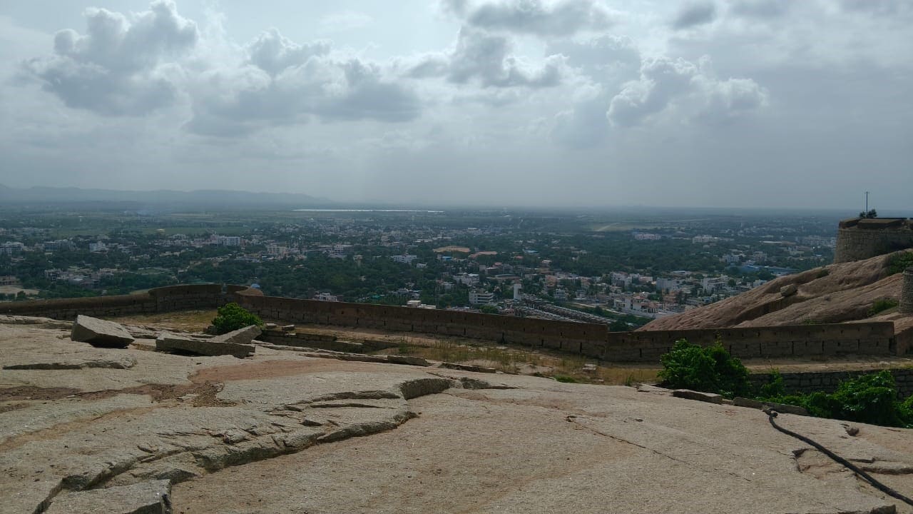
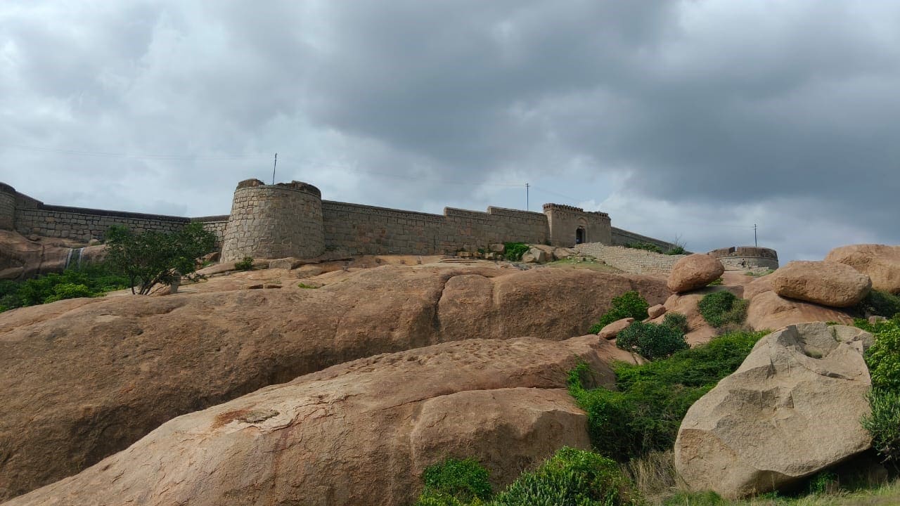
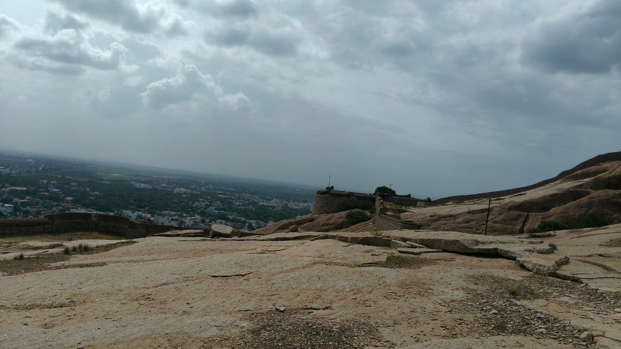
The Fort at Bellary is located to the north-east of the town over a hill at a height of 602.4 meters above the mean sea level. It is around 5.6 kmin circumference. The antiquity of the hill dates back to prehistoric times. Neolithic Celts, axes, chisels, and a large variety of pottery were reported from this place.
The Bellary Fort, located in Karnataka, boasts a rich history spanning over 3000 years. It was initially built during the Vijayanagara Empire by Hanumappa Nayaka. Later, Hyder Ali captured it in 1769 and renovated it with the help of a French engineer. The fort is famous for being built on a rock and divided into Upper and Lower Forts.
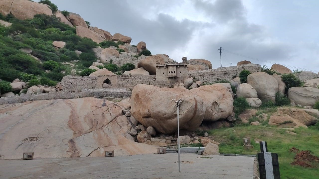
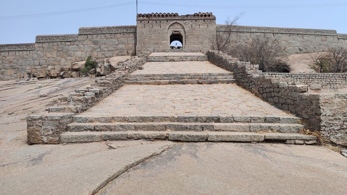
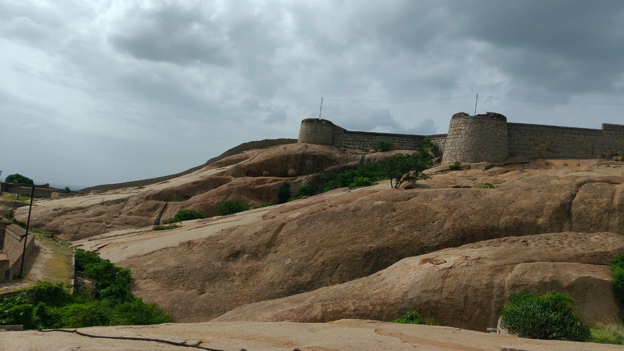
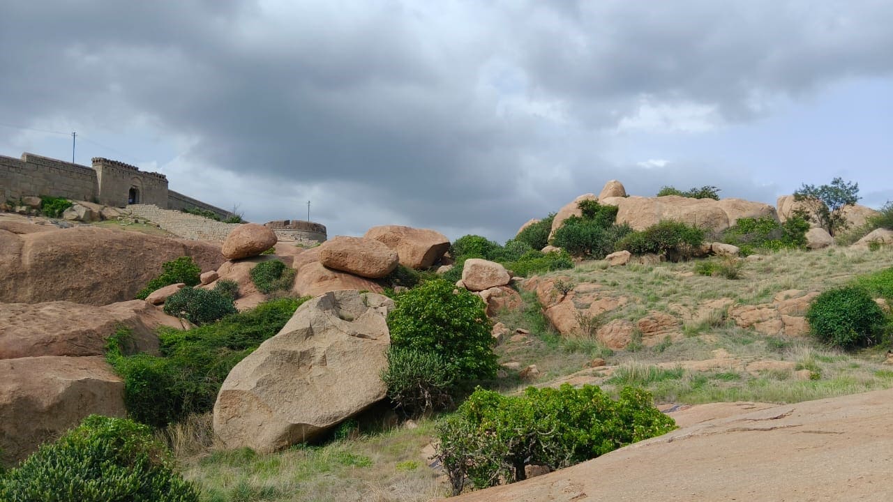
The fort, built of cyclopean masonry, is granite and set in lime mortar, having a coping of brick-and-lime and musket holes, is roughly triangular, with semi-circular and circular bastions at regular intervals. The main arched entrance leads to the inner court dotted with a couple of secular structures of rubble, besides remains of temples on the peak of the hillock and a few ponds having a perennial source. A huge natural pond of irregular shape is at the top of the hillock.
After the partial destruction of the Vijayanagara empire in the Rakkasatangadi war of 1565 C.E., small ruling chiefs became powerful in and around Bellary (Bellary’s old spelling) region; among such chiefs, namely Hanumappa Nayaka, a local chieftain gained importance in Bellary and he who strengthened the defenses of this fort at Bellary. In the meantime, the Marathas also had sway over the region for a short period. Later in 1775 C.E., it was captured by Haider Ali and passed it on to his son Tippu Sultan in 1784 CE, who administered it till 1792 CE. After a short rule of the Nizam, the fort was taken over by the English in 1800 CE.
ಟಿಪ್ಪು ಸುಲ್ತಾನನ ಮೇಲಿನ ಕೋಟೆ:
(ಟಿಪ್ಪು ಸುಲ್ತಾನನ ಮೇಲಿನ ಕೋಟೆಮತ್ತುಅರಮನೆ ಮತ್ತು ನಾಗಲಚೆರುವುಎಂದುಅಧಿಸೂಚಿತವಾಗಿದೆ)
ಸ್ಥಳ: ಬಳ್ಳಾರಿ, ತಾಲ್ಲೂಕು&ಜಿಲ್ಲೆ: ಬಳ್ಳಾರಿ, ಭೂ ನಿರ್ದೇಶನ: ಅಕ್ಷಾಂಶ 15 149086 ಉ.; ರೇಖಾಂಶ 76 91 ಪೂ
ಗೆಜೆಟ್ಅಧಿಸೂಚನೆ ಸಂ.: ಎಫ್4-33(5)/39ಎಫ್, ದಿನಾಂಕ 28-03-1940, ತಲುಪುವಿಕೆ: ವಿಮಾನ ನಿಲ್ದಾಣ: ಬೆಂಗಳೂರು ರೈಲ್ವೆ ನಿಲ್ದಾಣ: ಬಳ್ಳಾರಿ, ಬಸ್ ನಿಲ್ದಾಣ: ಬಳ್ಳಾರಿ
ಳ್ಳಾರಿ ಪಟ್ಟಣದಈಶಾನ್ಯಕ್ಕಿರುವ ಬೆಟ್ಟದ ಮೆಲೆ ಸಮುದ್ರಮಟ್ಟದಿಂದ 602.4 ಮೀಟರ್ಎತ್ತರದಲ್ಲಿ ಬಳ್ಳಾರಿ ಕೋಟೆಯಿದೆ. ಇದು ಸುಮಾರು 5.6 ಕಿ.ಮೀ. ವ್ಯಾಸವನ್ನು ಹೊಂದಿದೆ. ಈ ಬೆಟ್ಟದ ಪ್ರಾಚೀನತೆಯನ್ನು ಪ್ರಾಗಿತಿಹಾಸ ಕಾಲಕ್ಕೆ ಒಯ್ಯಬಹುದಾಗಿದೆ. ನವಶಿಲಾಯುಗದ ಕಾಲದಕೈಗೊಡಲಿ, ಉಳಿಗಳು ಮತ್ತು ವಿವಿಧ ಮಾದರಿಯ ಮೃತ್ಪಾತ್ರೆಗಳು ಅಧಿಕ ಪ್ರಮಾಣದಲ್ಲಿದೊರಕಿವೆ.
ಕಣಶಿಲೆಯನ್ನು ಬಳಸಿ ಅಸಮವಾದ ಭಾರಿ ಗುಂಡುಕಲ್ಲುಗಳಿಂದ (ಛಿಥಿಛಿಟoಠಿeಚಿಟಿ) ಕಟ್ಟಿದಕೋಟೆಗೋಡೆಯಿದೆ. ಇದರ ಮೇಲ್ಭಾಗವನ್ನುಇಟ್ಟಿಗೆ ಮತ್ತು ಸುಣ್ಣದಗಾರೆಯನ್ನು ಉಪಯೋಗಿಸಿ ಹೊದಿಸಿದಂತೆ ರಚಿಸಲಾಗಿದ್ದು ಬಂದೂಕು/ಫಿರಂಗಿಯ ನಳಿಕೆಗೆ ತ್ರಿಕೋನಾಕಾರ ರಂಧ್ರಗಳನ್ನು ಅಳವಡಿಸುವುದರೊಂದಿಗೆ ನಿಯಮಿತ ಅಂತರಗಳಲ್ಲಿ ಅರ್ಧಚಂದ್ರಾಕಾರ ಮತ್ತುದುಂಡನೆಯ ಬುರುಜುಗಳೊಂದಿಗೆ ಕೋಟೆಯನ್ನು ನಿರ್ಮಿಸಲಾಗಿದೆ. ಕಮಾನು ಪ್ರವೇಶದ್ವಾರವುಕೋಟೆಯ ಒಳ ಆವರಣಕ್ಕೆ ತೆರೆದುಕೊಳ್ಳುತ್ತದೆ. ಅಲ್ಲಿ ಉರುಟುಕಲ್ಲುಗಳಿಂದ ಕೂಡಿರುವಒಂದೆರಡು ಲೌಕಿಕ ಕಟ್ಟಡಗಳು ಮತ್ತು ಬೆಟ್ಟದ ಮೇಲಿನ ಭಾಗದಲ್ಲಿದೇವಾಲಯದ ಅವಶೇಷಗಳು ಹಾಗೂ ಸರ್ವಋತು ಕೊಳಗಳು ಮತ್ತು ಬೆಟ್ಟದತಪ್ಪಲಿನಲ್ಲಿ ನಿರ್ದಿಷ್ಟಆಕಾರವಿಲ್ಲದ ಸ್ವಾಭಾವಿಕ ಹೊಂಡವಿದೆ.
ಕ್ರಿ.ಶ. 1565ರ ರಕ್ಕಸತಂಗಡಗಿಯುದ್ಧದ ನಂತರ ಭಾಗಶಃ ನಾಶವಾದ ವಿಜಯನಗರ ಸಾಮ್ರಾಜ್ಯದ ನಂತರ ಬಳ್ಳಾರಿಯ ಸುತ್ತಮುತ್ತಲಿನ ಪ್ರದೇಶಗಳಲ್ಲಿ ಕಿರು ಆಳರಸರು ಪ್ರಬಲರಾದರು. ಅವರುಗಳಲ್ಲಿ ಸ್ಥಳೀಯ ನಾಯಕನಾದ ಹನುಮಪ್ಪ ನಾಯಕನು ಮುಖ್ಯತ್ವವನ್ನು ಪಡೆದು ಬಳ್ಳಾರಿ ಕೋಟೆಯರಕ್ಷಣಾ ಭಾಗಗಳನ್ನು ಬಲಪಡಿಸಿದನು. ಈತನ್ಮದ್ಯೆ ಮರಾಠರು ಈ ಪ್ರದೇಶದ ಮೆಲೆ ಅಲ್ಪಕಾಲದವರೆಗೆತಮ್ಮಅಧಿಪತ್ಯವನ್ನು ಹೊಂದಿದರು. ಕ್ರಿ.ಶ. 1775ರ ನಂತರ ಹೈದರ್ಅಲಿಯು ವಶಪಡಿಸಿಕೊಂಡ ಈ ಪ್ರದೇಶವು ಅವನ ಮಗ ಟಿಪ್ಪುಸುಲ್ತಾನನಿಗೆಕ್ರಿ.ಶ. 1784ರಲ್ಲಿ ವರ್ಗಾವಣೆಯಾಯಿತು. ಅವನು ಕ್ರಿ.ಶ. 1792ರವರೆಗೆ ಆಡಳಿತವನ್ನು ನಡೆಸಿದನು. ನಿಜಾಮರಅಲ್ಪಕಾಲದ ಆಳ್ವಿಕೆಯ ತರುವಾಯಕ್ರಿ.ಶ. 1800ರಲ್ಲಿ ಇಂಗ್ಲೀಷರುಕೋಟೆಯನ್ನು ವಶಪಡಿಸಿಕೊಂಡರು.